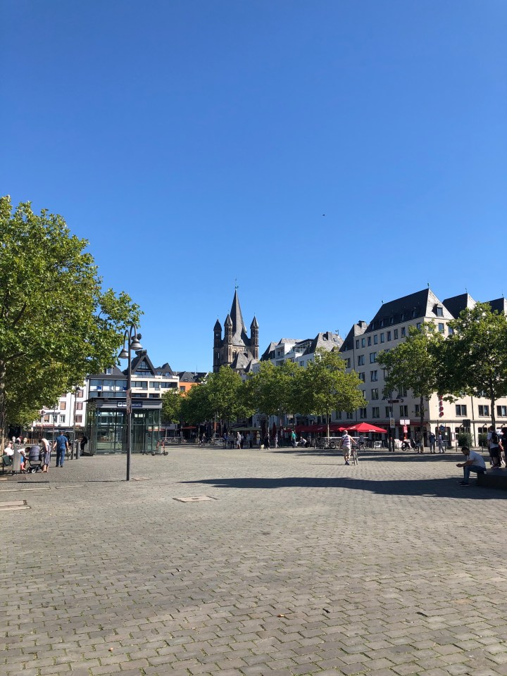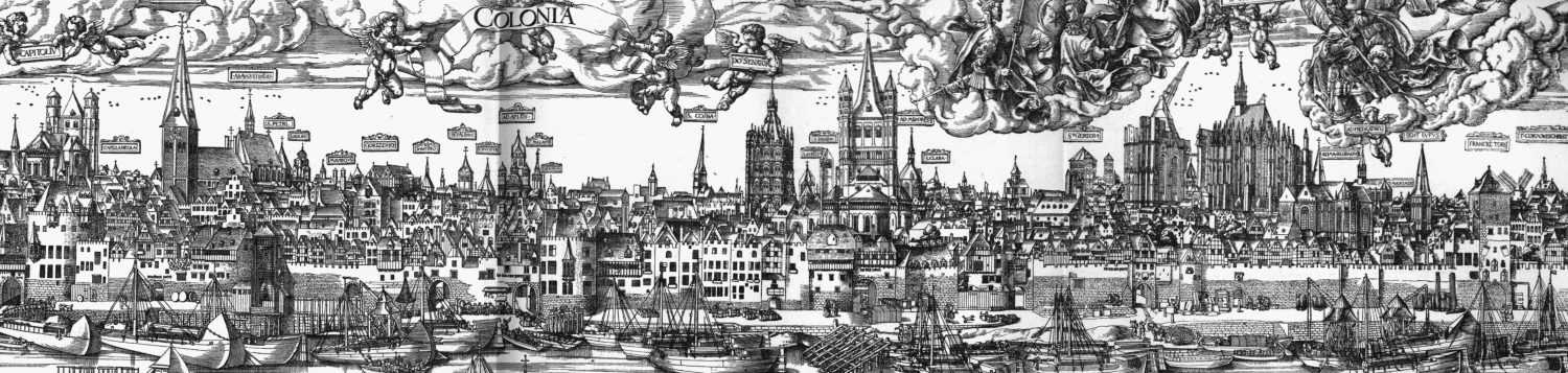
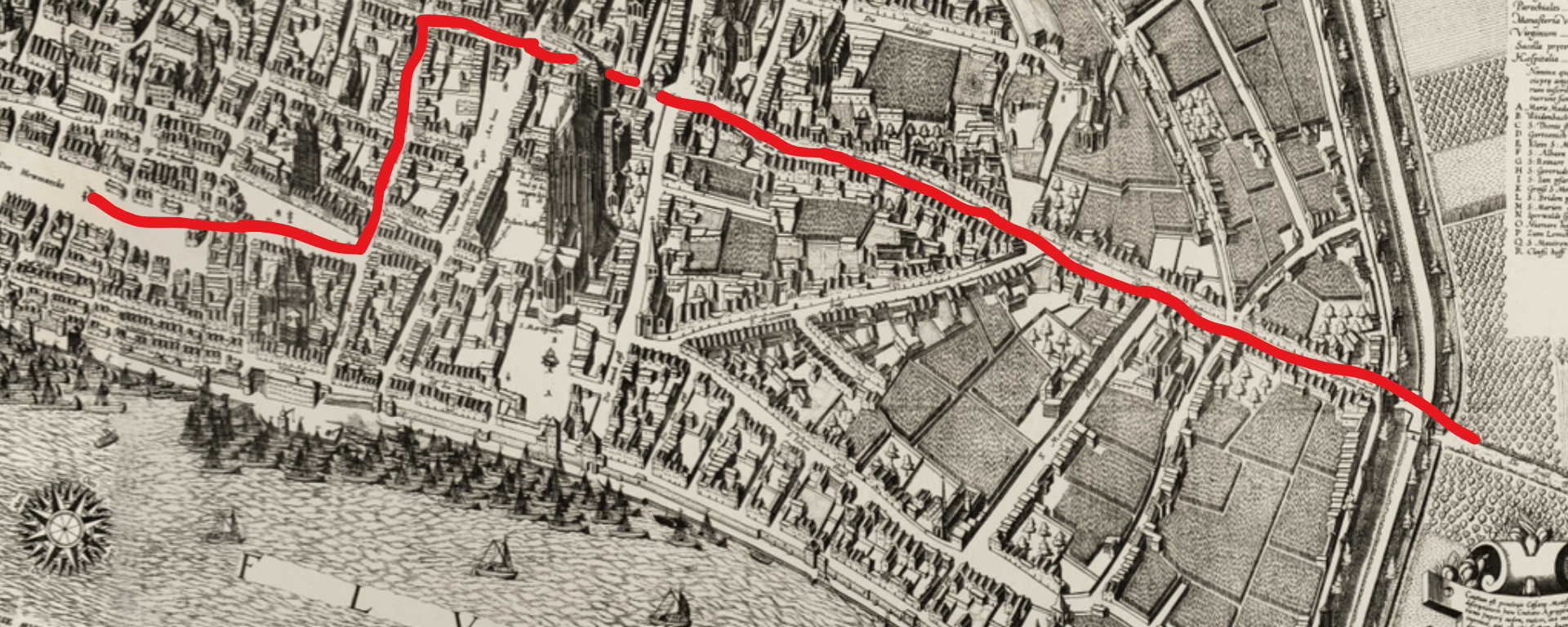
Cologne has won the Battle of Worringen in 1288. Let’s celebrate! A street-level walk through 14th-century Cologne. Follow the path of a medieval procession from the northern gates down to the riverfront markets, passing craft workshops, ancient Roman arches, and the unfinished Gothic cathedral along the way.
Places we walk by on our route through medieval Cologne
The Eigelstein Gate
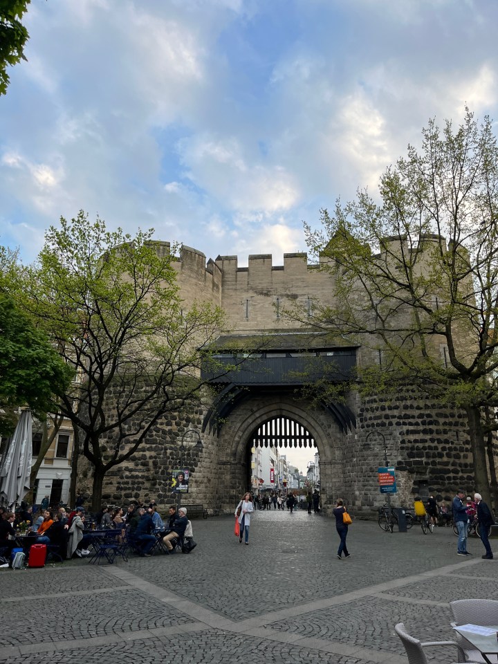
The Eigelstein Gate (Eigelsteintor) was the main northern city gate of medieval Cologne. Positioned along an ancient Roman military road leading north toward Neuss, it was one of 12 landward gates built into the city’s 8-kilometer medieval wall.
The gate marked the entry point to Niederich, a northern district defined by its distinctly rural atmosphere of vegetable garden plots, monasteries, and roadside breweries. On June 5, 1288, the gate served as the backdrop for Cologne’s triumphal procession following the Battle of Worringen, where jubilant crowds gathered to welcome returning citizens and the captured wooden standard cart of Archbishop Siegfried von Westerburg.
The captured Banner Cart of Archbishop Siegfried of Westerburg
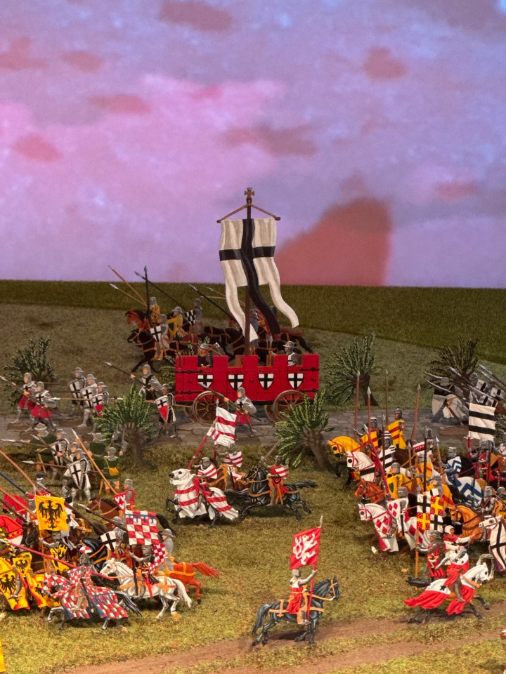
The Archbishop’s standard-bearing cart was a two-axle wooden vehicle designed to resemble a small, mobile knight’s castle on wheels. Built with wooden battlements along its top and painted a bright red, the cart featured coats of arms on its sides displaying a black cross on a white background—the personal emblem of Archbishop Siegfried von Westerburg. Resting inside the cart lay the Archbishop’s giant, torn-down war banner, which likewise bore the black cross insignia.
Functionally, the vehicle served as the official command and standard-bearing cart for the Archbishop during the Battle of Worringen on June 5, 1288. Following the Archbishop’s defeat that afternoon, citizen troops from Cologne captured the cart on the battlefield and brought it through the northern Eigelstein Gate, parading it down to the Alter Markt as a prized war trophy. The captured cart became an enduring symbol of the city’s triumph over its former lord and marked the emergence of Cologne as a de facto Free Imperial City.
Following the victory, Cologne preserved the cart for more than five centuries inside its municipal armoury (Zeughaus) as a monument to civic independence. In 1794, when French Revolutionary troops marched into Cologne, they discovered the ancient wooden cart in the armoury, mistook it for useless junk, and burned it—symbolically bringing Cologne’s long era as a Free Imperial City to an end.
St. Ursula & the Dominican Monastery
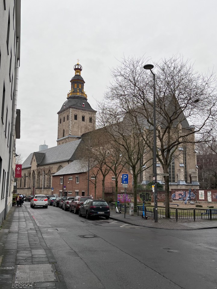
Located along the route leading south from the Eigelstein district toward Cologne’s city center, the venerable convent church of St. Ursula was a major religious and economic landmark in the northern district of Niederich. The monastery was home to around forty noble canonesses who brought their personal fortunes and servants to the sanctuary, contributing significantly to the surrounding neighborhood’s standing.
Beyond the private riches of its noble residents, the convent itself had been endowed over time with extensive property and landholdings. This vast network of estates made St. Ursula an influential institution whose wealth and reach extended far beyond the Rhineland.
Trankgasse & the Cathedral Construction Site
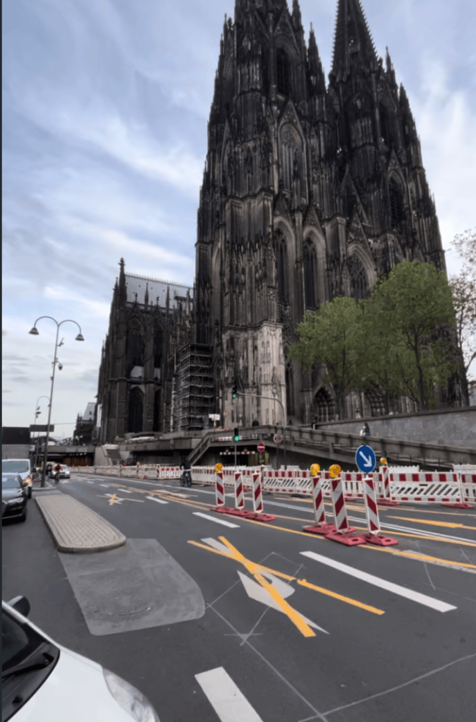
Trankgasse, historically known as the drancgazzen, was a key thoroughfare leading down to the Rhine and the city’s busy river harbor. The street derived its name from its essential role in the construction of Cologne Cathedral: ships anchored along the river unloaded heavy stone and building supplies, which were then hauled up the cathedral hill by horses and oxen. Trankgasse was the precise location where these draft animals were gathered, watered, and fed.
By around 1300, the street was lined with grand mansions, spacious courtyard inns, and the stately residences of high-ranking members of the Cathedral Chapter, including the Cathedral Provost. It also offered a dramatic view of the monumental cathedral construction site. From Trankgasse, one could see the striking contrast of the truncated old Carolingian cathedral—kept standing so pilgrims could still reach the Shrine of the Three Kings—rising alongside the towering new Gothic choir, whose stone walls were already climbing toward their eventual height of forty-three meters.
Pfaffenpforte & Unter Fettenhennen
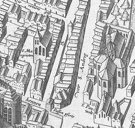
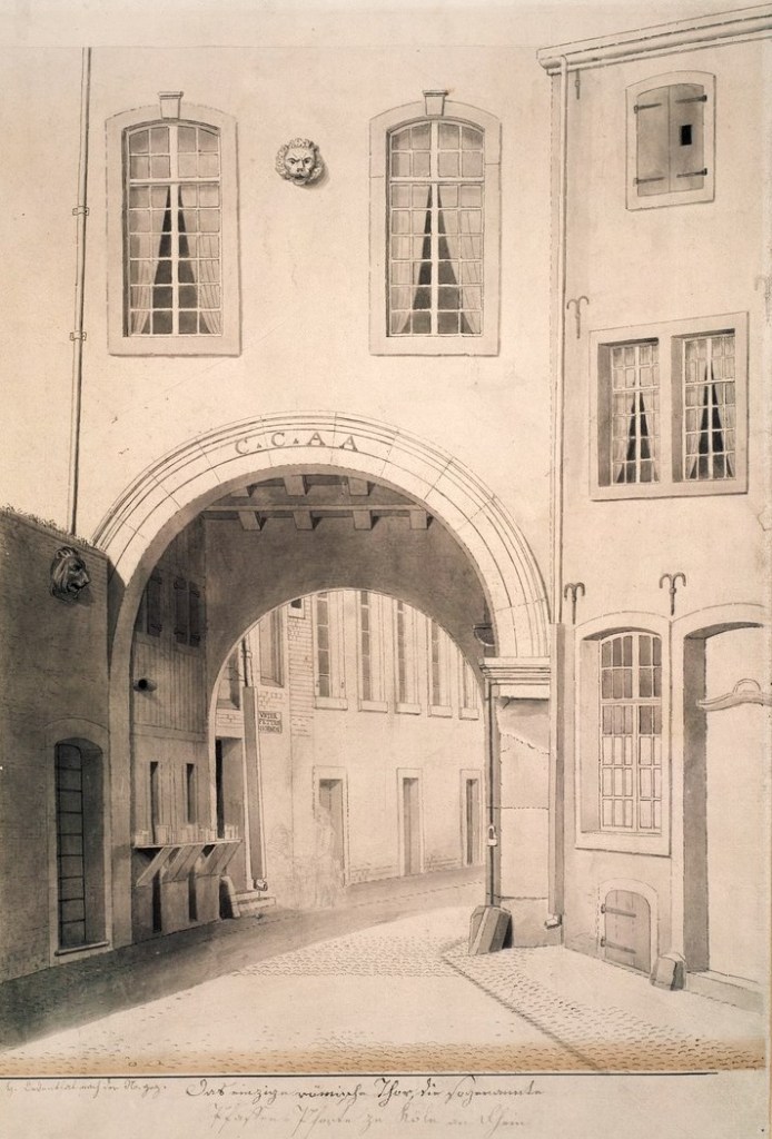
Leaving the cathedral behind and continuing south, the walking route passes through an ancient archway integrated into the Cathedral Deanery (Domdechanat). This archway was in fact the surviving structure of Cologne’s ancient Roman North Gate. Well into the 19th century, parts of this Roman gateway remained standing as part of the deanery, where the Cathedral Dean—the deputy to the Provost responsible for the spiritual administration of the cathedral—resided.
To the people of Cologne around 1300, this gate was commonly known as the Pfaffenpforte (Priests’ Gate). According to a famous medieval legend, two cathedral canons were hanged at this very gate after a failed attempt to assassinate Mayor Gryn using a lion. As the story goes, the battle-hardened mayor wrapped his cloak around one arm for protection and drove his dagger into the beast. While modern historians recognize the story as a medieval myth, citizens in Maria’s day regarded it as living truth and a stark warning to the clergy not to challenge the city’s political leadership.
Directly past the gate, the route continues down the Roman north-south road onto the street known as Unter Fettenhennen(Unter Fetten Hennen). The street took its name from a prominent house known aszu der fetten Henne(“At the Fat Hen”), located around modern house number 7, which likely featured a sign or figure depicting a fat hen on its facade. According to local lore, the hen earned its name thanks to a bakery operating right next door; chickens kept in nearby backyards would frequently slip onto the street to gorge themselves on discarded breadcrumbs and baked goods, growing noticeably plump in the process.
Hohe Straße ( up deme Steynwege ) & Am Hof
Turning off Unter Fettenhennen onto Cologne’s premier north-south artery, the route enters the street known around 1300 as up deme Steynwege (“On the Stone Road”). Originating as the ancient Roman Cardo Maximus—once walked by emperors such as Trajan, Hadrian, and Constantine—the street earned its medieval name because it was continuously paved with stone, setting it apart from the city’s mostly dirt, gravel, and unpaved lanes.
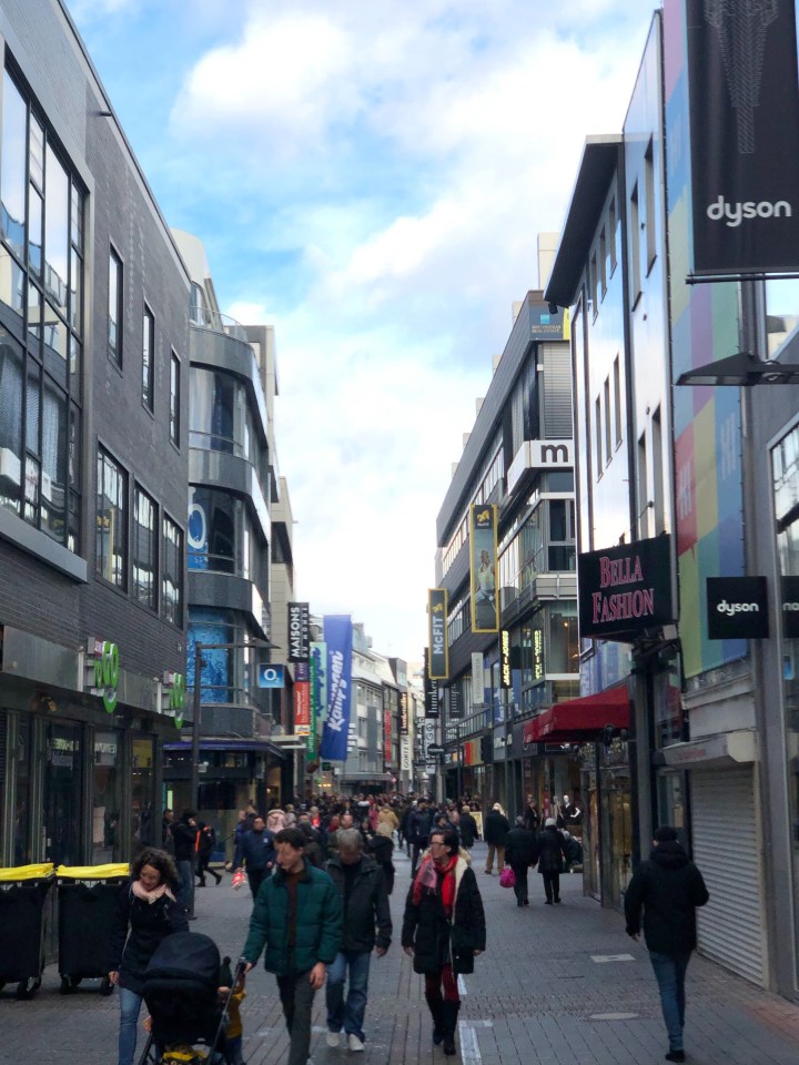
By 1300, the street had established itself as Cologne’s economic heart, lined with grand stone mansions, guild houses, and meeting places for powerful trade associations. Remarkably for a city that proudly referred to itself as “Holy Cologne,” not a single church or monastery occupied building land along this lucrative commercial strip, with the sole exception of the expansive Augustinian monastery. Instead, different sections of the street bore descriptive names reflecting the specific crafts based there, such as Unter Pfannenschläger (pan-smiths), Unter Wappensticker(embroiderers), and Unter Spormacher (spur-makers), giving the avenue a bustling, mixed-trade character where business and money reigned supreme.
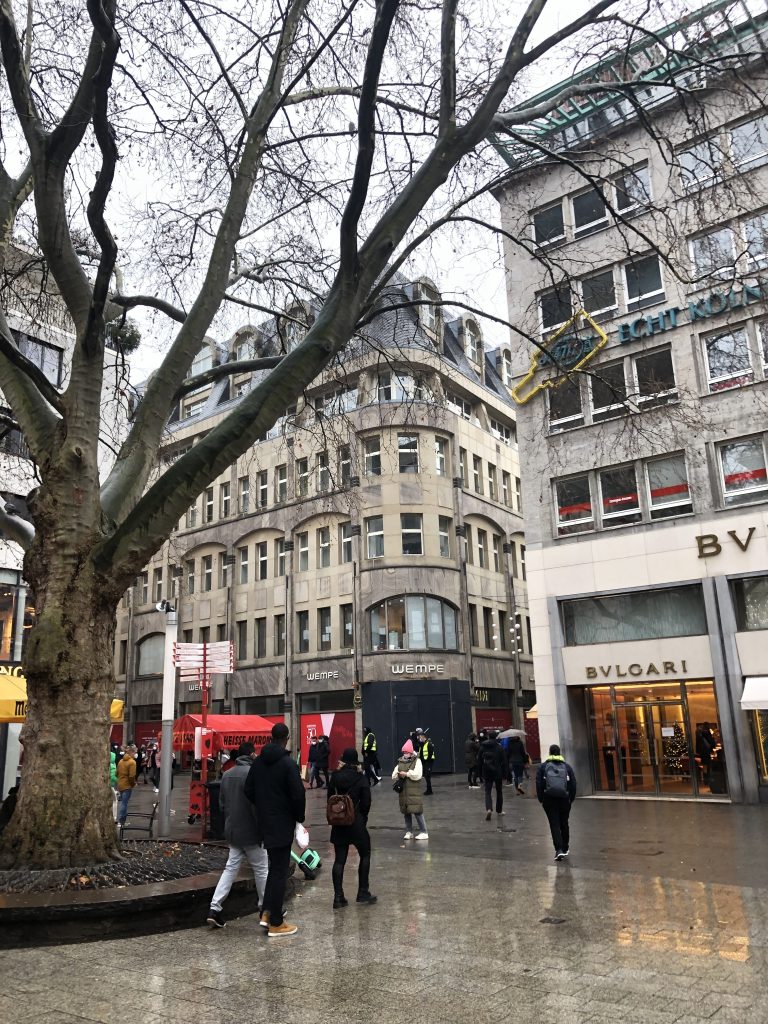
Standing at the northern junction of the street, one could look east down toward the Rhine along Am Hof and see the stately, three-story Romanesque palace of the Archbishop of Cologne. Built in the 12th century by Archbishop Rainald von Dassel, the palace fell into disuse following the Battle of Worringen in 1288, as the exiled archbishops were no longer permitted to exercise power within the city. Over time, local merchants cheekily built market stalls and houses directly against the abandoned palace walls, transforming the once-royal site into a lively market area. Officially renamed Hohe Straße in 1812, this ancient thoroughfare has maintained its unbroken two-thousand-year legacy as Cologne’s primary shopping street.
Budengasse & the Jewish Quarter
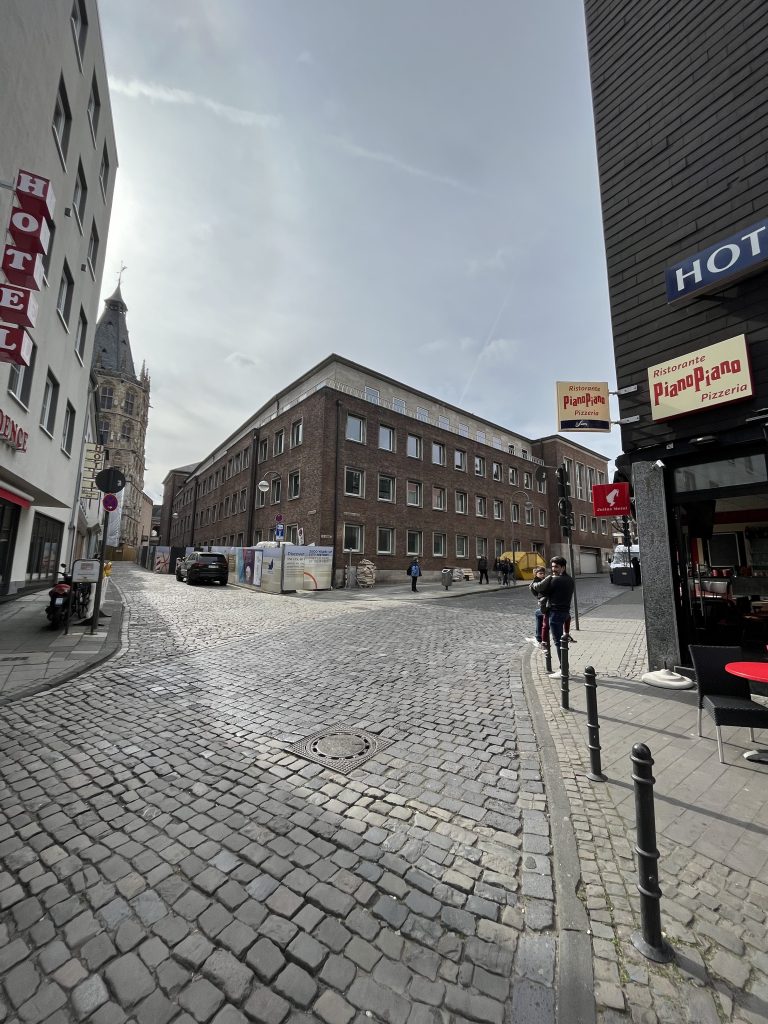
Turning left off Hohe Straße and heading east toward the Rhine, the route enters Budengasse, which is split into Große Budengasse and Kleine Budengasse. While popular legend suggests the street was named after small market stalls (Buden) lining the road, historians note that stalls were ubiquitous across medieval Cologne. Instead, the name likely derives from the old word Butte—referring to a wooden serving bowl (Daubenschale)—or possibly from Bote(Botengasse).
Following a gentle downward slope off the flood-safe hill originally chosen by the Romans, Budengasse sits directly above an extraordinary piece of ancient infrastructure: the subterranean Roman sewer network, which still exists intact beneath the pavement today.

Directly along the street’s southern edge lay the northern boundary of Cologne’s Jewish quarter. Around 1300, conditions for the city’s Jewish population had grown increasingly difficult; excluded from most professions and unfairly suspected of aiding the exiled Archbishop, residents of the quarter were forced to pay double protection taxes to both the Archbishop and the City Council.
Alter Markt to Heumarkt
Emerging from Budengasse, the procession enters the Alter Markt, the commercial and political heart of medieval Cologne. Created in late antiquity following the silting up of an old arm of the Rhine, market life shifted here from the ancient Roman forum. Surrounding the square stood the predecessor to Cologne’s town hall, housing the city council and the prestigious Richerzeche (Brotherhood of the Rich), alongside bustling merchant homes. Beyond daily trade, the square hosted grand medieval tournaments and festivities, including the famous celebration in 1235 for the English princess Isabella. Lined with stone residences, the houses along the market bore vivid animal names on their facades to guide passersby, such as zum Luchs (“At the Lynx”), zum Elefanten (“At the Elephant”), and zum Papagei (“At the Parrot”). It was here on the Alter Markt that the triumphal parade culminated and the captured banner cart finally came to a halt.
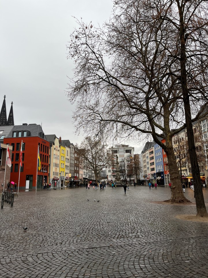
Leaving the Alter Markt, a short stroll down the street called Unter Käster connects directly to the Heumarkt. The street took its name from the local box-makers (Käster), who crafted wooden trunks to pack goods for transport and frequently sold clothing, like stockings and trousers, directly out of their chests.
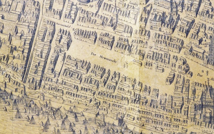
Reaching the immense Heumarkt, the square opened up as a sprawling commercial hub lined with the stately homes of merchants and master craftsmen. Over centuries, the area had been repeatedly filled and leveled to accommodate massive trade activity. Historically, the square was also where the famous Cologne silver pfennig was minted—a trusted currency accepted far beyond the city’s borders. For Maria and her father, whose home lay just south of the square, reaching the Heumarkt marked the peaceful end of their evening stroll across medieval Cologne.